A ZIP code is the five-digit postal code the U.S. Postal Service uses to sort and deliver mail. ZIP stands for Zone Improvement Plan, the system USPS launched on July 1, 1963. Every U.S. address has one, and most also have a nine-digit ZIP+4 that narrows delivery down to a street or building.
What does ZIP code mean?
“ZIP” is an acronym for Zone Improvement Plan and was chosen to suggest that mail moves faster, as if zipping along, when senders use the code. A ZIP code is therefore not a word of its own but the name of a U.S. numbering system. Outside the United States the same idea is called a postal code or postcode; the difference is explained in ZIP code vs. postal code.
What each of the five digits means
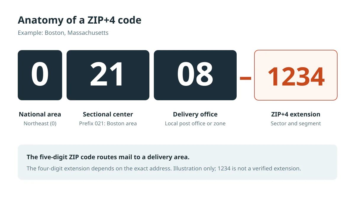
USPS describes the structure this way: the first digit represents a general geographic area of the nation, from 0 in the East to 9 in the West; the next two identify a regional area; the final two identify a specific post office (USPS Postal Facts).
| Digits | Example: 02108 | What they identify |
|---|---|---|
| 1st | 0 | National area (Northeast) |
| 2nd–3rd | 21 | Regional mail-processing center (the prefix 021 covers the Boston area) |
| 4th–5th | 08 | Delivery post office or zone (downtown Boston) |
The state directory shows which states use each first digit, and ZIP prefixes explains the three-digit groups.
Are all ZIP codes 5 digits?
Yes: a complete ZIP code always has five digits, including any leading zeros. In 1983 USPS added the optional four-digit ZIP+4 extension so mail could be sorted to a specific street, and in 1991 two more digits were added for sorting to a single delivery point, used in barcodes rather than written addresses (USPS). So you may see 5, 9 or, in barcodes, 11 digits. Find your nine-digit code with the ZIP+4 lookup.
How many ZIP codes are there?
USPS reports 41,554 ZIP Codes in the country (USPS Postal Facts, updated May 2026). Our reference dataset holds 41,706 codes because it also keeps some military, territorial and retired codes; see About our ZIP code data. Counts change as USPS adds and retires codes.
How are ZIP codes assigned?
USPS assigns codes to delivery routes and post offices as its network changes, not to fixed map areas. That has practical consequences:
- A city can have dozens of ZIP codes, and one ZIP can cover several towns or counties.
- ZIP codes can change when routes are reorganised, so an old code may stop working.
- Map outlines of ZIP codes are approximations, such as the Census Bureau's ZIP Code Tabulation Areas; see ZIP code demographics.
Types of ZIP codes
- Standard: street addresses and PO Boxes in an area.
- PO Box only: boxes at one post office.
- Unique: one high-volume recipient. USPS cites 12345 as a unique ZIP for General Electric in Schenectady, New York (see 12345).
- Military: APO, FPO and DPO mail; see military ZIP codes.
What is a mail code?
Some universities, companies and agencies use internal “mail codes” or “mail stops” to route post inside their own campus after USPS delivers it. A mail code is written on an address line but is not a ZIP code, and it does not replace the five-digit ZIP.
Keep the leading zero
ZIP codes are labels, not numbers. Codes in New England, New Jersey, Puerto Rico and the Virgin Islands begin with 0, and the lowest in our dataset is 00501. A spreadsheet that stores 02108 as the number 2108 silently corrupts it; our Excel guide shows how to keep the zero.